CHCNAV CTS-R100 Robotic Total Station
The CHCNAV CTS-R100 is a robotic total station engineered for construction surveying. With 2″ angle accuracy, intelligent trajectory prediction and automatic prism reacquisition for uninterrupted oper...
CHCNAV CTS-R100 Robotic Total StationCHCNAV CTS-R100 Robotic Total Station
Download Datasheet

Product Overview

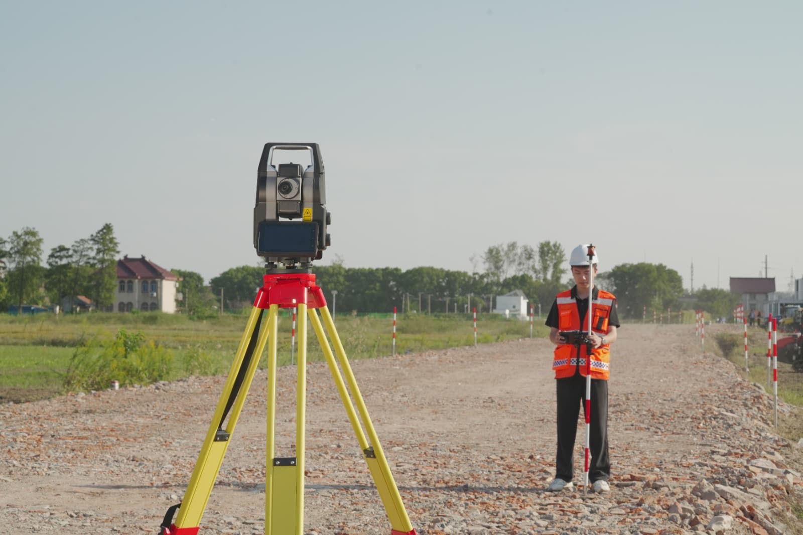
The CHCNAV CTS-R100 is a robotic total station engineered for construction surveying. With 2″ angle accuracy, intelligent trajectory prediction and automatic prism reacquisition for uninterrupted operation, it keeps work moving on site. LandStar 8 enables direct CAD stakeout from DWG, DXF and PDF files and a unified project database for GNSS and total station workflows, while SiteCloud connects office design, field operations and as-built verification. Contact Plantec for a quote.

Technical Specifications

Angle & Prism Measurement
Angle Accuracy2″
Minimum Reading0.1″
Prism Range5000 m (array) / 3500 m (single)
Prism Accuracy2 mm + 2 ppm (fine)
Tracking Accuracy5 mm + 2 ppm
Reflectorless & Tracking
Reflectorless RangeUp to 1000 m (reflective sheet)
Reflectorless Accuracy2 mm + 2 ppm to 10 mm + 2 ppm
ATR Range1000 m (standard circular prism)
ATR Accuracy (80 m)1″
ATR Search Time0.3 s
Telescope & Servo
Magnification30×
Field of View1°30′
Focusing Range1.6 m to infinity
Max. Rotation Speed180°/s
Face Change Time≤ 3 s
Display & Software
Display6.0 in HD LCD, 1280 × 720
Operating SystemAndroid 9.0
ProcessorMSM8953 octa-core, 1.8 GHz
Memory3 GB RAM / 32 GB ROM
Imaging5 MP off-axis camera
Power & Connectivity
Battery4720 mAh, 14.4 V
Continuous Operation4 hours
Charging Time3 h (Type-C) / 4 h (Type-A)
InterfacesType-C, Type-A, RS232
CompensatorDual-axis, ±4° range
Physical & Environmental
Weight (with battery)8.0 kg
Dimensions225 × 230 × 385 mm
Operating Temperature−20°C to +50°C
Water & Dust ResistanceIP54
Laser PlummetClass 2, ≤ 0.4 mm at 1.5 m

All specifications are subject to change without notice. Measurement ranges are based on the conditions stated in the datasheet.

Why Choose the CTS-R100?

Keep Tracking, Recover Fast

Trajectory prediction and multiple search strategies help reacquire a lost prism, typically within 15 seconds, so there is less manual prism searching after obstructions.

Pick It on CAD, Stake It on Site

Import DWG, DXF and PDF files and select design elements directly from the map view for stakeout, with no manual coordinate entry.

One Site, One Software

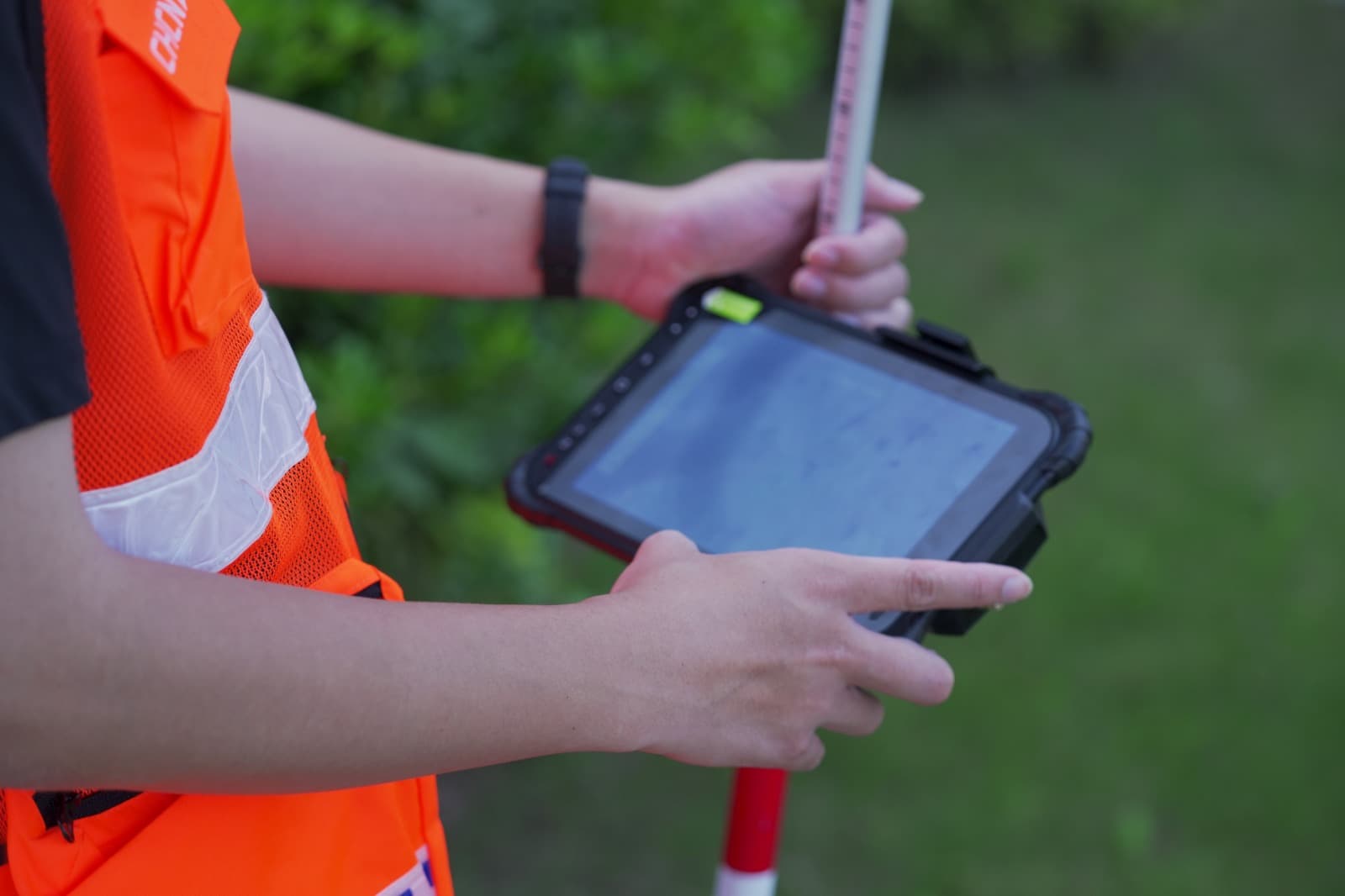
LandStar 8 brings GNSS and total station measurements into a single application with one shared project database, and RTK-assisted setup.

One Design, Every Machine

SiteCloud connects office design, field operations and as-built verification, so everyone works from the latest design files and costly rework is reduced.

Frequently Asked Questions

What is the CHCNAV CTS-R100?▼
The CTS-R100 is a CHCNAV robotic total station engineered for construction surveying. It combines 2″ angle accuracy, automatic prism reacquisition and a 6-inch Android display running LandStar 8 for CAD stakeout and topographic surveying.
How accurate is the CTS-R100?▼
Angle accuracy is 2″. Prism measurement accuracy is 2 mm + 2 ppm in fine mode and 5 mm + 2 ppm in tracking mode. ATR positioning accuracy is 1″ at 80 m.
What is the measurement range?▼
Up to 5000 m to a prism array and 3500 m to a single prism. In reflectorless mode it measures up to 1000 m to a reflective sheet, with accuracy of 2 mm + 2 ppm at the shortest range, up to 10 mm + 2 ppm between 500 m and 1000 m. Ranges depend on atmospheric conditions, as detailed in the datasheet.
What happens if the prism is lost?▼
Trajectory prediction and multiple search strategies help the instrument reacquire a lost prism, typically within 15 seconds, reducing manual intervention on site.
Can I stake out directly from CAD files?▼
Yes. LandStar 8 can import DWG, DXF and PDF files so you can select design elements from the map view and stake them out without typing coordinates.
Can I use the same software for GNSS and total station work?▼
Yes. LandStar 8 supports both GNSS and total station measurements in one application with a shared project database, and RTK measurements can assist total station setup.
How long does the battery last and how rugged is it?▼
The 4720 mAh, 14.4 V rechargeable battery provides around 4 hours of continuous operation and charges in about 3 hours via Type-C. The instrument is rated IP54 and operates from −20°C to +50°C.
How much is the CTS-R100?▼
Pricing depends on configuration, accessories and training. Get a quote from Plantec, the UK's authorised CHCNAV dealer, and we will come back to you with a tailored price and delivery times.

Want a price or a demo? Contact Plantec for a quote.

Delivery & Returns

Free Delivery on all orders

View our returns policy

Applications

Construction Stakeout
Stake out design points and lines directly from CAD drawings on site.
Road & Infrastructure
Set out and check alignments, kerbs and levels for road and civil works.
Topographic Surveying
Collect accurate topographic detail with prism and reflectorless measurement.
Landscaping Stakeout
Lay out landscape designs with fast prism reacquisition and a streamlined workflow.
Have any questions?
Email
enquiries@plantec.uk
Phone
+44 (0) 1924 910 533

CHCNAV CTS-R100 Robotic Total Station

0
Get a quote